This blog is intended to show you how to measure your garden yourself to create a survey plan so that in the event you do not have a professional land survey or detailed property site plan, you can measure, draw and detail key features on your property yourself. If you do it yourself, you can save the cost of having a someone visit your site to do it for you.
DIY Designs online landscape services are happy to use information you gather yourself to create a scaled plan of your existing garden in birds-eye view to get things started. While measuring up your garden may sound a little challenging it is well within most people’s ability. You will however need to take care and measure twice!
A good way to get started on your DIY site measure is with a starter plan outlining the property’s boundaries or the key areas that require design solutions. Many councils have on-line mapping available that show the property boundaries and services. If this is available, we will provide a working document to get you started. Some Council information also shows the contours of a site and if available we will include this on the starter plan.You just print it off and overlay your measurements on it. A satellite plan or an existing floor plan of your house is another good starting point for a measure up.
Below is an example of a starter plan with contours and a satellite site image.


You will need:
- A decent tape measure, typically an 8-metre builder’s tape measure works well.
- Paper. Lot's of paper! Graph paper can be helpful for creating a sense of scale as you draw, as each square can be used to represent a metre. We don't expect your plan to be to scale, so don't worry if you don't have any. Just use a blank, good sized piece of paper such as A3. This can be two sheets of A4 printer paper taped together if that's all you have.
- A clipboard or something hard to press on.
- Pencil / ruler for notations. A three colour pen can be helpful for showing different things.
- About an hour to do a full measure and detail it.
- A fine day. Nothing worse than doing this in the rain!
- A helper is useful, but not essential
There are different types of measurements you can use for your survey.
1. Direct Line Measurement: This is when you simply measure a point from A to B
2. A Running Dimension: Similar to the direct line measurement except you measure a series of points along the same line. This is particularly useful when measuring a house Just start at one corner and run your long tape along the wall and record the positions of doors and windows along the same line. You can use this same technique for plotting key plant spacings in a garden bed.
3. Triangulation: This is a the best way to establish the position of buildings on a site in relation to the corners of the garden and can also be used to fix the position of trees etc. Use the length of one wall of the house as one of your triangle sides, then take a measurement from each end of the same wall to the same corner, which then gives you your three side of a triangle.
What order should I do my survey in?
You can either draw each area of the garden as you go – draw, measure, next area, draw, measure, next area etc. Or you can quickly sketch out the shape of the house first, then go back and take your detailed measurements for each area. Whatever works best for you.
What should I include on my DIY survey plan:
- The outline (footprint) of the house, garage and any other structures. Measure from the external walls (not the eaves) so the plans will reflect the greatest surface area available.
- Note any external doors and any key windows which have important view lines
- Show the location of the building structure on the site. Even builder’s plans sometime differ from what is shown on plans and what was built so record the distance of these structures from the boundaries. For best accuracy use triangulation method to lock the house into position in relation to the boundary and also take measurements from each of the house corners straight out to the boundary from each wall. Record the measurements on your plan.

- Add existing landscape features that you want to keep or modify, decks, patios, steps etc and show the measurements (dimensions) of these. For steps include the width and depth (tread). Also note the overall height of the steps. Do this by calculating the overall height of the individual steps (risers).
- If you have features or areas that are difficult to present on your drawing you can draw these at larger scale on a separate piece of paper. Just include a simple reference label.
- Plot in any known building services such as drainage sumps, gas metres, air conditioning units and drainpipes from the roof.
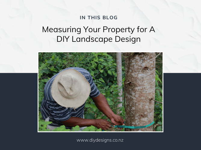
- Show the location of major trees that you wish to retain.
- Also note on your survey any important things such as view-lines that you wish to shield, or keep.
Do I need property levels for my garden design?
Levels are the changes of height across a property.
Generally anything less than a one metre level change across a property will typically be absorbed during the build process. Greater than this may require specific design aspects and will need to be clearly identified in the site measure process
The more information you give us regarding site levels the more precise your landscape design will be, resulting in an easy garden build. Some changes in level can be easily gained with a tape measure.
Important - If you have significant change of levels on your property, then we would require spot levels to be provided. This typically would entail a skilled person with a laser level to undertake this work.
Can I use software to record my measurements and create my survey plan?
- Sure, this is fine. There are many tools available though many free versions restrict the output so check first
- We require any electronic plan file to be a PDF or DWG file without watermarks showing
- If you just plan to use the old pen and paper then best to use the base starter plan we will supply if available, which generally it is.
Some professional advice:
If you are planning to build fences, any structures or other such works on your property boundary we recommend that you save yourself potential grief and cost by accurately locating boundary pegs or hiring a registered surveyor to peg your boundary before any landscape construction works are started.
